


Parcel Lineage
Connected parcel history & change data
Track parcel changes with precision
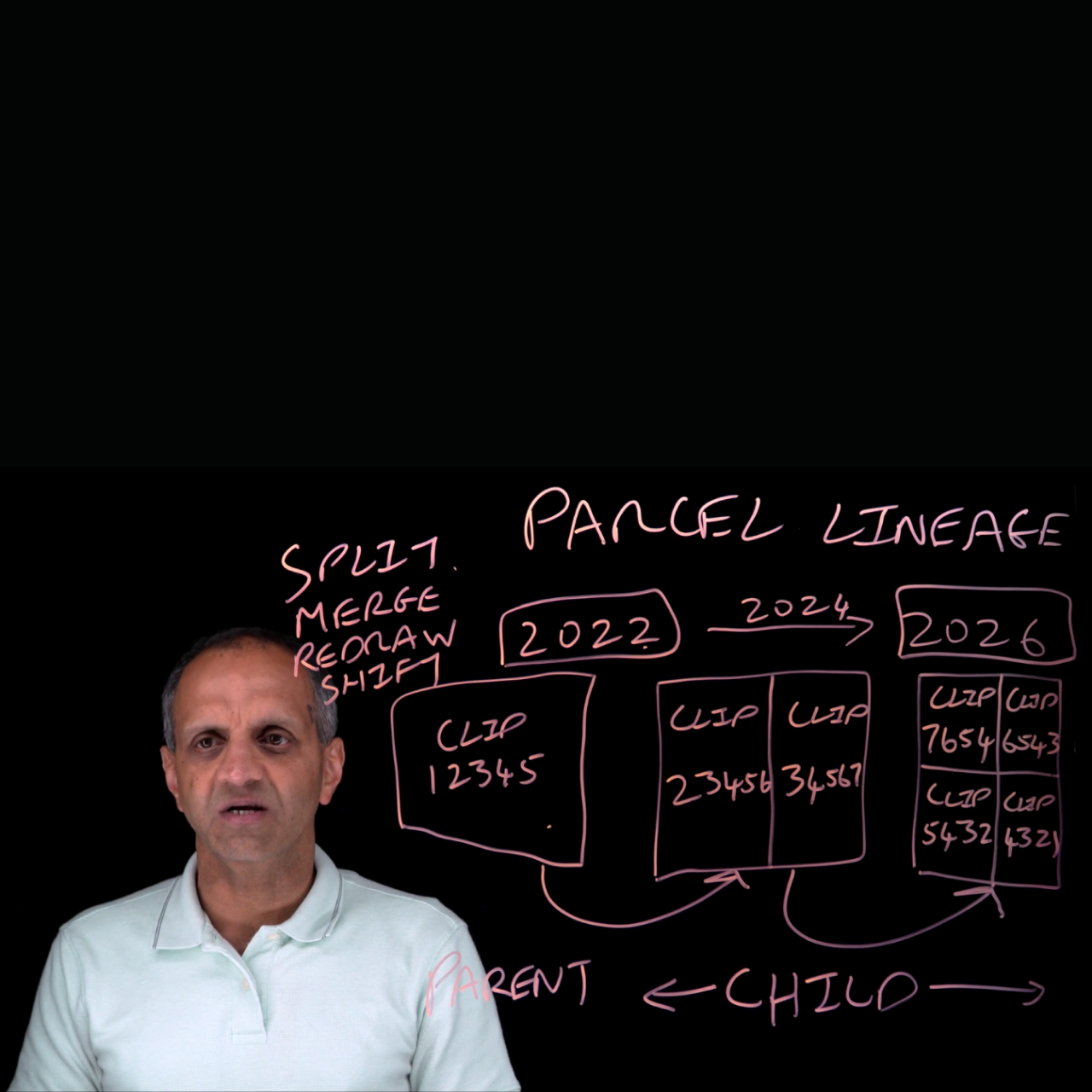
Parcel Lineage helps organizations understand how parcel boundaries change over time. Delivered as one data product with three connected datasets—parent, child, and event—it links previous and current parcel shapes and classifies changes such as splits, merges, shifts, and redraws. With annual parcel shape history dating back to 2019, persistent shape identifiers, representative CLIPs, and overlap statistics, Parcel Lineage supports geospatial analysis, subdivision tracking, territory mapping, land research, tax reassessment, and planning workflows.
Key product attributes
- Single data product with a 3-dataset structure: Parent represents previous parcel shapes, child represents current parcel shapes, and event links the 2 with change details.
- Event classification: Identifies parcel changes such as splits, merges, shifts, and redraws.
- Representative CLIPs included: Provides representative CLIP® (Cotality’s Integrated Property) IDs for parent and child parcels associated with lineage events. This unique property identifier, powered by CoreAI, connects all records related to a property across our data sources.
- Annual lookback to 2019: Includes annual parcel shape history back to 2019.
- Event-based coverage: Includes only parcel shapes that pair as lineage events between vintages, not every parcel shape.
- Efficient tracking: Quickly detect and quantify parcel growth—such as subdivisions and land use changes—without manually comparing multiple vintages.
- Comprehensive coverage: Covers all 50 states and the District of Columbia.
- Monthly updates: Ensures access to the latest parcel change data across all covered geographies.
- Geospatial compatibility: Designed for use with all leading visualization tools.
- Unique identifiers: Provides unique identifiers for each parcel shape to maintain accurate records.
- AI-ready data (delivered with semantic companion files)
Pricing varies based on volume, geography, and delivery.
FAQ
What is Parcel Lineage?
What datasets are included?
What types of parcel changes does it identify?
Does Parcel Lineage include every parcel?
Who can benefit from Parcel Lineage?
How can we help you?
Let's get this conversation started! Our team is here to provide you with more information and answer any questions you may have.
Trying to reach us by phone?
Get in touch with our sales team at (866) 774-3282. We're here Monday to Friday from 7 a.m. to 5 p.m. CT.
Looking for support?
Visit our dedicated support page to find support for all our products.