
Overview

A multi-state severe weather outbreak swept across Wisconsin, northern Illinois, and northwest Indiana on Monday, July 27, 2026, producing a damaging urban tornado, additional tornado reports across the Chicago metropolitan area, and very large hail. The most significant damage occurred in Wisconsin's Fox Valley, where the National Weather Service rated a tornado that struck Menasha, Appleton, and Neenah an EF-3 on the Enhanced Fujita scale with maximum winds of 140 mph, placing it in the middle of the EF-3 range of 136 to 165 mph.
Figure: Map of tornado damage probability near Appleton, Wisconsin
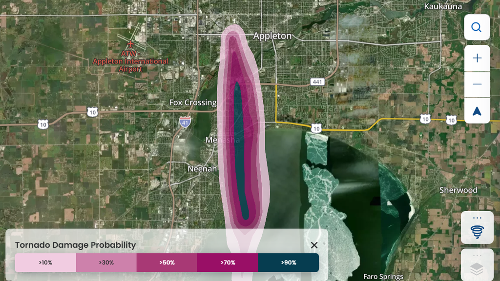
Data source: Cotality Insight™, 2026
Storm reports indicate the Fox Valley tornado crossed Lake Winnebago before striking the communities along its northern shore beginning around 12:20 p.m. local time. The City of Menasha declared a local State of Disaster, enforced an overnight curfew, and issued a boil water notice for portions of Menasha and Fox Crossing as crews responded to gas leaks, downed power lines, and debris-blocked streets. Damage assessments are ongoing and the count of affected structures is expected to grow.
Hail reports stretch into Chicagoland
Hail was a major component of the event. Preliminary reports include hailstones of 2 to 2.5 inches in diameter across Chicago's western suburbs, including Clarendon Hills, Downers Grove, and Westmont in DuPage County, a 3-inch stone near Shorewood in Will County, and tennis ball size hail in Iroquois County. In Wisconsin, hail up to 2 inches fell widely, with one Shawano County report exceeding 4 inches.
Figure: Map of hail verification near Chicago, Illinois
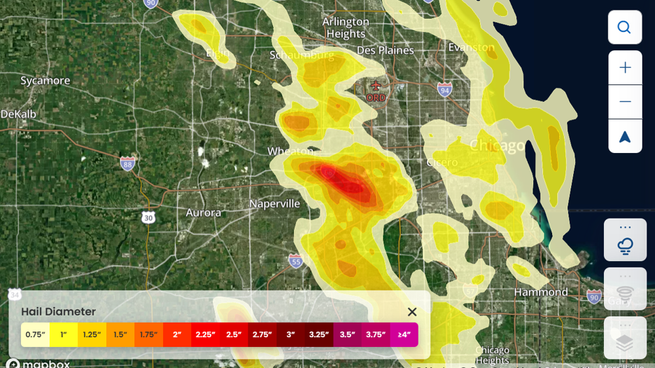
Data source: Cotality Insight™, 2026
"The tornadoes will dominate the headlines, but the hail footprint is what turns this into a major aggregation event," said Curtis McDonald, director of product management and meteorologist at Cotality. "Stones of 2 inches or larger are big enough to compromise roofs and siding outright, and Monday's swath tracked across some of the densest rooftop exposure in the Midwest. When hail that size falls over hundreds of thousands of structures, the cumulative claim volume can rival or exceed the tornado losses themselves."
What this means for insurers
This outbreak combined two distinct loss drivers across one of the most heavily insured corridors in the Midwest. The Fox Valley EF-3 may produce concentrated pockets of severe structural loss, including roof and wall failures that push claims toward total values, while the tornado touchdowns and giant hail across Chicagoland and northwest Indiana may generate a high-frequency layer of roof and siding claims over a very large exposure base. Severe convective storm events of this footprint, spanning a major metropolitan area, frequently aggregate into significant industry losses even when no single community's damage dominates headlines.
Cotality will continue to monitor these events and may provide updates when available.