


Overview

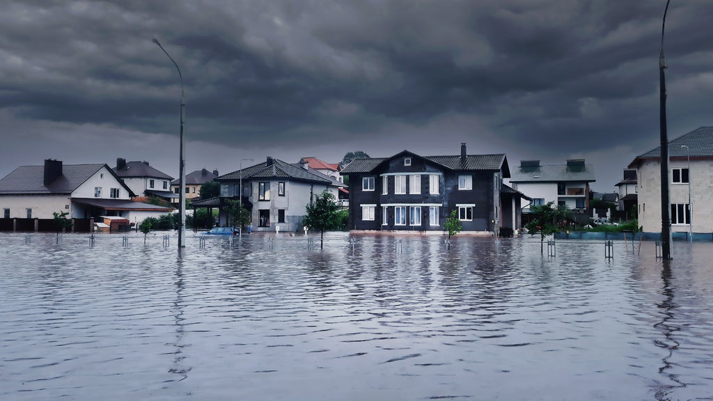
For the second time in 10 days, historic flooding has struck the Four Corners region, where Arizona, Colorado, New Mexico and Utah meet. An atmospheric river brought heavy rain from Saturday night, Oct. 31, through Monday, Nov. 2, sending the same rivers back over their banks.
Rainfall totals were generally lower than during the Oct. 22 to 23 flood, but the ground had not dried out. In several places, rivers rose even higher than they did last month. The National Weather Service in Grand Junction used the "Particularly Dangerous Situation" heading when it issued a flood warning for parts of southwestern Colorado and southeastern Utah.
"The second storm didn't need to be bigger than the first to cause as much damage," said Howard Botts, chief scientist at Cotality. "Soils were still saturated from October, and rain fell on fresh snow at high elevations. Much of that water ran straight into rivers that had never returned to normal levels."
Cotality's Flood Risk Score shows that many of the neighborhoods that flooded in October carry meaningful flood risk.
Flood risk beyond the floodplain
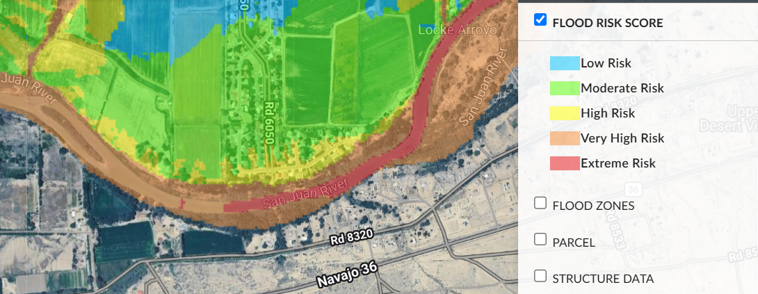
In late October, floodwaters damaged dozens of homes in Harper Valley, a subdivision west of Farmington, New Mexico, that sits on a bend of the San Juan River. Cotality's Flood Risk Score places much of the neighborhood at moderate to high flood risk, with very high to extreme risk along the riverbank. The score looks beyond federal flood zone boundaries, which helps identify homes that face flood risk even when they are not in a mapped floodplain.
Figure 1: Cotality Flood Risk Score in the Harper Valley area west of Farmington, New Mexico
Source: Cotality Riskmeter, 2026
Harper Valley is part of a broader pattern in San Juan County, where the Animas and La Plata rivers join the San Juan River. The governor's office estimates that thousands of homes in the county and surrounding areas were damaged in the first flood.
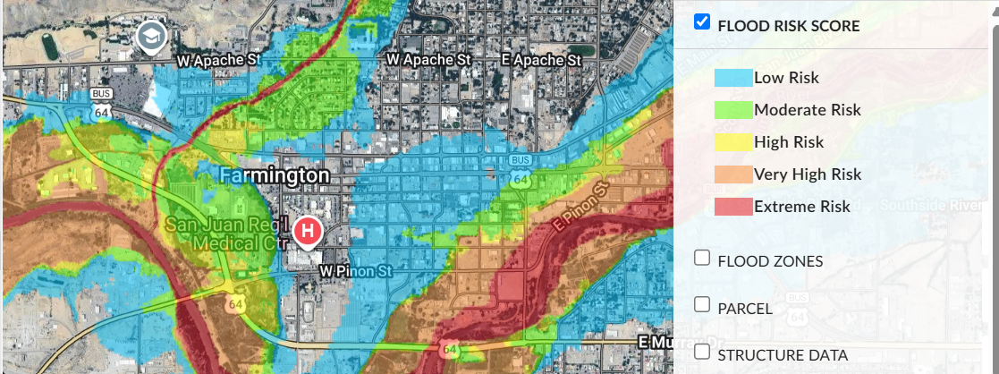
In and around downtown Farmington, Cotality's Flood Risk Score shows bands of high to extreme risk following the rivers and the washes that feed them, with moderate risk reaching into nearby residential blocks.
Figure 2: Cotality Flood Risk Score in Farmington, New Mexico
Source: Cotality Riskmeter, 2026
What this means for insurers
Much of this damage is likely to go uninsured. Standard homeowners policies exclude flood, and flood insurance take-up is low across the rural Southwest and on tribal lands.
"Harper Valley shows the gap between where people assume flood risk ends and where it actually is," Botts said. "Flood zone maps are a starting point, but property-level risk scores can reveal exposure that a floodplain boundary misses. That matters most in inland watersheds, where saturated ground can turn a moderate storm into a major flood within hours."
Cotality will continue monitoring this event and may provide updates when available.
