Overview

Update: August 17, 2026
The fires north of Reno are winding down. The Bug Fire, now mapped at 94,105 acres, reached more than 80% containment by Monday morning, and the Stallion Fire stands at 81% containment. Fire behavior has stayed quiet since late last week, and the perimeters are effectively final.
Officials have confirmed nine homes destroyed, concentrated in the Red Rock Road area. Given the exposure at stake when the fires were running toward the Cold Springs corridor, the structure toll represents a significant save by fire crews, aided by the timely turn in the weather.
Nearly all evacuations have been lifted, including the Rancho Haven community, whose residents returned home over the weekend, and all Washoe County schools reopened Monday. Highway access has been restored across the fire area.
Update: August 14, 2026
Firefighters are finally gaining ground on the fires north of Reno. The Bug Fire has grown to 88,421 acres but containment has climbed from 0% to 31%, while the Stallion Fire stands near 33,700 acres at 44% containment. Thunderstorms brought rain and higher humidity over the fire area, slowing fire behavior even as lightning and gusty outflow winds briefly grounded suppression aircraft and put parts of the burn area under a flash flood watch.
Roughly 13,000 residents evacuated at the peak of the fires. Conditions have improved enough that evacuation orders for the Red Rock Road and Hungry Valley areas have been reduced to warnings and some residents are returning home, though access to Pyramid Lake remains closed, US 395 saw an overnight closure at the state line, and nine Washoe County schools stayed closed Friday.
Based on Aug. 14 fire perimeters from Washoe County, Nevada, and Lassen and Sierra counties, California, Cotality data shows 226 residential properties with a combined reconstruction cost value of approximately $99.4 million are currently or were previously inside the Bug Fire perimeter.
Cotality is monitoring the event closely and may provide updates as more data becomes available.
Update: August 12, 2026
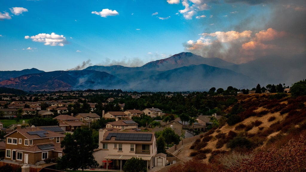
A fast-moving, wind-driven wildfire complex is burning along the California-Nevada border just north of Reno, forcing evacuations across several communities and prompting Nevada to declare a state of emergency for Washoe County.
The Bug Fire ignited Saturday, Aug. 8, in the dry terrain of Lassen and Sierra counties in California and has since merged with the Fred Mountain Fire, swelling to roughly 62,000 acres at 0% containment as of Tuesday night, according to CAL FIRE and local incident reporting.
The nearby Stallion Fire has burned more than 20,000 additional acres, and Wednesday morning reporting put the combined footprint of the fires near 100,000 acres. Fire behavior has been extreme: observers documented a fire tornado as the blaze made wind-driven runs through critically dry fuels, and containment fell from 3% back to 0% as the fires merged.
Cotality data indicates that there are over 12,450 properties carrying a moderate or greater wildfire risk in the Reno metropolitan area. Those properties have a combined Reconstruction Cost Value (RCV) of over $10.3 billion.
"The Reno area is one of the fastest-growing wildland-urban interface markets in the West, and this complex is testing exactly the corridor where that growth has concentrated," said Cotality Director of Hazard Insights Jamie Knippen. "With more than 12,450 properties at moderate or greater wildfire risk and over $10 billion in reconstruction cost value in the metro area, the difference between a contained fire and a wind-driven run into the Cold Springs subdivisions is measured in billions, not millions."
Communities evacuated north of Reno
Evacuation orders cover the community of Cold Springs, home to roughly 9,000 people on the US 395 corridor at the state line, along with parts of the rural Palomino Valley and the town of Nixon on the Pyramid Lake Paiute Reservation.
Thousands of residents are under orders or warnings, homes have been destroyed although officials have not yet released a damage tally, and strike teams remain deployed for structure protection.
The impacts reach into the Reno-Sparks metropolitan area, home to about half a million people: nine Washoe County School District schools are closed, more than 3,700 customers have lost power, and smoke has pushed air quality into unhealthy ranges for sensitive groups.
The region has seen destructive wildland-urban interface fires before, including the 2024 Davis Fire south of Reno and the 2011 Caughlin Fire in southwest Reno, but the current complex is many times larger than those events and is burning toward exurban subdivisions with continued wind in the forecast.
What this means for insurers
The exposure at risk is concentrated in the wildland-urban interface communities north of Reno, where single-family homes, ranch properties, and outbuildings meet open rangeland.
With the fire uncontained and red flag conditions persisting, the structure count remains the key uncertainty; a wind shift toward the Cold Springs subdivisions would materially change the loss picture.
Insurers should anticipate claims for destroyed and damaged dwellings, smoke damage, additional living expenses from the mass evacuations, and potential business interruption tied to school and road closures
Cotality is monitoring the event closely and may provide updates as more data becomes available.