


NZ MasterMap
Trusted spatial data for decisions
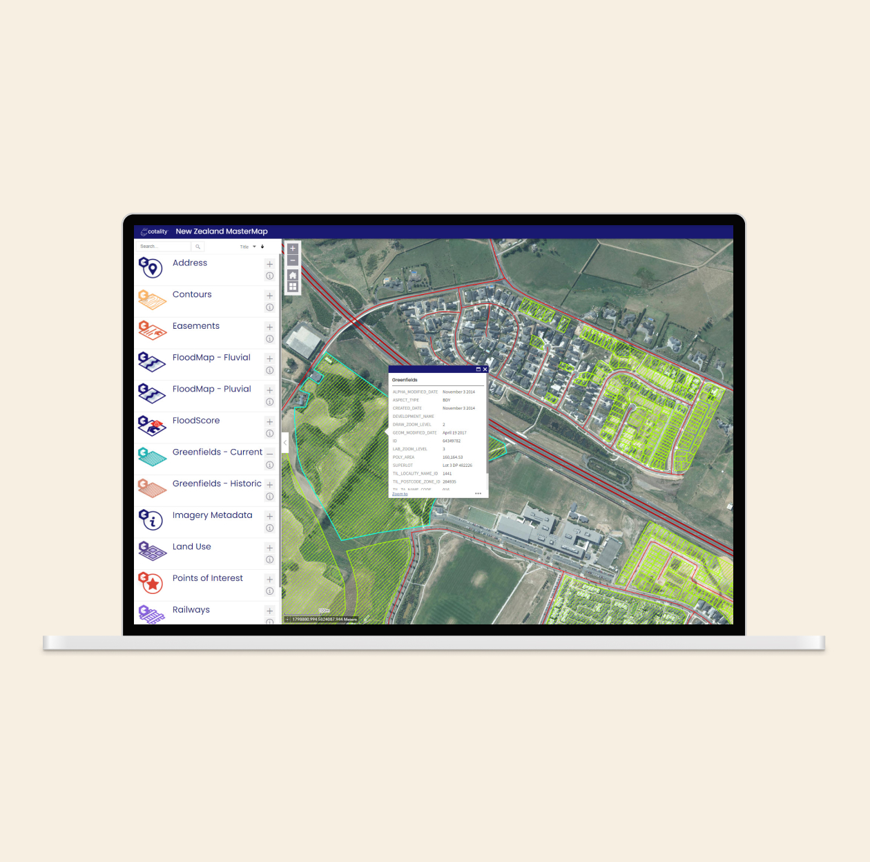
The geospatial foundation for critical decisions
NZ MasterMap is Cotality’s authoritative geospatial dataset, offering the most comprehensive and manually validated address and mapping data in New Zealand.
Maintained by a dedicated in-house GIS team, it supports accurate planning, emergency services, network infrastructure, insurance assessments and more.
With over 2.5 million verified physical addresses and robust spatial accuracy, NZ MasterMap is trusted by first responders, government, insurers and utilities as the spatial foundation for operational and strategic decision-making.

Power emergency response
Equip emergency services with precise address data to improve dispatch accuracy and crisis coordination.
Plan and protect infrastructure
Support major utilities and telcos with network planning, asset management and service delivery using spatially accurate data.
Inform government services
Enable better urban planning, policy modelling and resource allocation through location-verified property data.
Strengthen insurance insight
Improve risk assessment and claims processing with accurate address locations and property footprint information.
A trusted spatial dataset for New Zealand
NZ MasterMap provides a precise, continually updated view of the built environment—supporting organisations where accuracy is critical.
Over 2.5 million verified addresses
Includes manually validated address points across New Zealand, ensuring exceptional data accuracy at the property level.
Verified by in-house GIS experts
Maintained by Cotality’s dedicated geospatial team, the dataset is regularly enhanced with rigorous quality control.
Comprehensive suite of data layers available - providing rich detail for spatial analysis and planning
Roads centrelines with comprehensive attribution to support network analysis. Also planned subdivisions, locations of interest, and contextual layers.
Flexible delivery options
Access NZ MasterMap via API, web interface or bulk delivery—tailored to support diverse operational and system needs.
2.5 million+
verified physical addresses
4,000+
weekly spatial data updates
100%
cloud free aerial imagery coverage
How can we help you?
Let's get this conversation started! Our team is here to provide you with more information and answer any questions you may have.
Trying to reach us by phone?
Get in touch with our sales team at 0800 355 355.
Looking for support?
Visit our dedicated support page to find support for all our products.