Overview

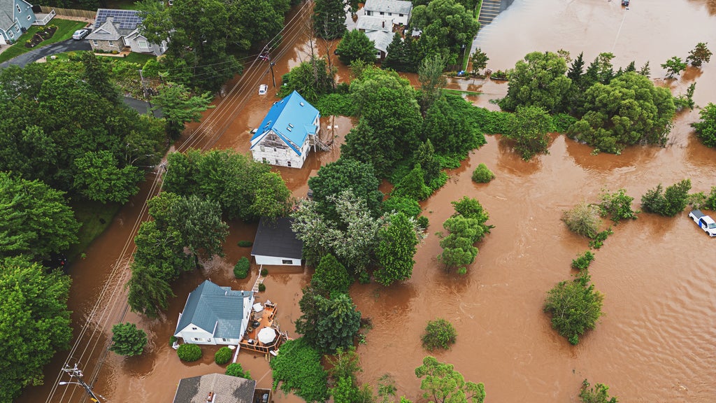
Hurricanes wear a coastal label, but their rain does not read maps. Recent seasons made that painfully clear: in 2024, Hurricane Helene pushed catastrophic freshwater flooding through mountain communities in the southern Appalachians, hundreds of miles from where the storm made landfall. As rainfall-induced — or pluvial — flooding reaches deeper inland, one measurement is emerging as the difference between a close call and a gutted first floor: the height of a home's first floor relative to base flood elevation.
What is base flood elevation, and why does it matter?
Base flood elevation is the height floodwater is expected to reach during a 100-year flood, meaning a flood with a 1% chance of occurring in any given year. If a home's first floor sits above that line, water is far more likely to stop at the doorstep. If it sits below, even a modest storm can put living space underwater. A difference of inches in first-floor height can translate into tens of thousands of dollars in damage, which is why granular elevation data has become essential to modern flood risk assessment.
Coastal homes face a massive elevation gap
The numbers along the coast are sobering. According to the 2026 Cotality Hurricane Risk Report, only 38.2% of homes in coastal flood zones are elevated above the 100-year base flood elevation. That means 61.8% of coastal residences sit below this critical safety line — a structural vulnerability built directly into some of the most storm-exposed real estate in the country.
Inland properties are not in the clear
Move away from the shoreline and the picture improves, but only somewhat. Cotality data shows that 39.6% of structures in high-risk inland flood zones still sit below base flood elevation. That translates to nearly 1.69 million homes in known high-risk inland areas that remain physically vulnerable to floodwaters breaching their first floor.
Different building codes and local topography likely explain why inland homes fare slightly better than coastal ones. But the takeaway is unavoidable: elevation risk is not a coastal problem. It is a national one, and it hides in neighborhoods that have never filed a flood claim.
The blind spot beyond the flood map
Traditional flood zone maps draw a binary line: a property is either in the 100-year floodplain or out of it. That framework misses enormous exposure. Cotality data reveals over $405.5 billion worth of residential property sits in areas where flood insurance is not mandatory, yet these homes face high risk from hurricane-driven flooding.
"When homeowners underestimate risk, they're less likely to invest in resilience," said Cotality Chief Scientist Howard Botts. "That's a serious problem in places where codes haven't caught up to environmental realities."
High-fidelity elevation data closes that gap. By analyzing first-floor height, lowest adjacent grade, and localized topography down to the single-meter level, modern models can pinpoint exactly which homes sit dangerously below base flood elevation — even when a legacy map calls them safe.
What this means for your book of business
For carriers and underwriters, these numbers describe hidden portfolio exposure. When 39.6% of structures in high-risk inland flood zones sit below base flood elevation, a meaningful share of any inland flood book carries physical vulnerability that a binary map never surfaced.
That vulnerability puts direct pressure on rate adequacy. Zones currently priced as low-risk can contain properties whose first floors sit inches below the waterline of a 100-year event, and premiums built on legacy boundaries may not reflect the losses those homes can generate.
The underwriting and pricing case is straightforward: “outside the flood map” means outside the mandatory-insurance line, not outside the risk. Treating map boundaries as safety guarantees leaves real exposure unpriced. Integrating first-floor height, lowest adjacent grade, and localized topography into underwriting and pricing decisions lets carriers see that exposure clearly — and write coverage with confidence where competitors still rely on the map.
Pluvial flooding is rewriting the geography of hurricane risk, and first-floor elevation data is the clearest lens available for seeing where the water will go. Read the complete 2026 Cotality Hurricane Risk Report to explore the full depth of hurricane risk data and insights.