Overview

Update: October 9, 2026
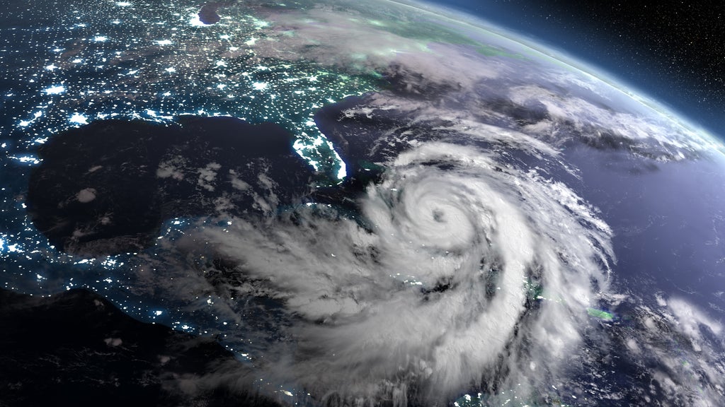
Isaias became a major hurricane on Friday morning, the first of the 2026 Atlantic season, and the forecast now puts the highest storm surge on the western Florida Panhandle.
Cotality data show that approximately 78,000 homes in Escambia, Santa Rosa, Okaloosa, and Walton counties sit at moderate or greater risk of storm surge damage, representing about $26.1 billion in reconstruction cost value (RCV). These four counties line the stretch of coast now forecast for 6 to 9 feet of surge. They also hold about 353,000 homes at moderate or greater hurricane wind risk, with about $115.8 billion in RCV.
Across the full Storm Surge Warning area, about 342,000 homes are at moderate or greater surge risk, with about $101.5 billion in RCV. That area runs from the mouth of the Mississippi River to the Suwannee River, covering 18 parishes and counties in Louisiana, Mississippi, Alabama, and Florida. Wind exposure in the eight Hurricane Warning counties is unchanged from the Oct. 8 update, with about 777,000 homes and $241.6 billion in RCV at moderate or greater risk.
Isaias reaches Category 3
At 7:20 a.m. CDT, the National Hurricane Center reported that Air Force Reserve Hurricane Hunters found maximum sustained winds of 120 mph, making Isaias a Category 3 hurricane on the Saffir-Simpson scale. The minimum central pressure was 959 millibars.
The center was about 240 miles south of Pensacola, Florida, moving north-northeast at 15 mph. Isaias is expected to turn north and speed up later today, then make landfall within the Hurricane Warning area tonight or early Saturday.
Forecasters still expect a sharp increase in wind shear to cause some weakening before landfall. Their best forecast calls for a high-end Category 2 hurricane at the coast. However, the National Hurricane Center noted that a delay of only about six hours in the onset of that shear could bring a stronger hurricane onshore.
The storm has also grown. Hurricane-force winds now extend up to 30 miles from the center, and tropical-storm-force winds reach up to 185 miles.
Storm surge forecast shifts east
The forecast track has shifted the greatest surge threat east of Mobile Bay. The National Hurricane Center now calls for 6 to 9 feet of storm surge from the Alabama-Florida border to Grayton Beach, Florida, which covers Pensacola Beach, Navarre, Fort Walton Beach, and Destin. Forecasters call for 4 to 7 feet from Grayton Beach to Indian Pass. The Mobile Bay forecast dropped to 3 to 5 feet.
The Storm Surge Warning now extends from the mouth of the Mississippi River to the Suwannee River in Florida's Big Bend.
Rainfall of 4 to 8 inches is expected across southern Alabama, the Florida Panhandle and Big Bend, and southwestern Georgia. Local totals up to 15 inches could cause considerable flash flooding and significant river flooding. Damaging wind gusts are also possible well inland across central and northern Alabama and parts of western and northern Georgia.
Cotality will continue monitoring this event and may provide updates when available.
Update: October 8, 2026
Hurricane Isaias is strengthening over the southern Gulf of America and is forecast to make landfall on the northern Gulf Coast late Friday, Oct. 9, or early Saturday, Oct. 10. The National Hurricane Center has issued a Hurricane Warning from Ocean Springs, Mississippi, to the Bay/Gulf County line in the Florida Panhandle. A Storm Surge Warning also stretches from the mouth of the Mississippi River to the Steinhatchee River, Florida. Isaias is the first hurricane of the 2026 Atlantic season.
Across the eight counties under the Hurricane Warning, Cotality data show that approximately 217,000 homes are at moderate or greater risk of storm surge damage, with a combined reconstruction cost value of about $65.2 billion. The hurricane wind risk reaches even more properties: roughly 777,000 homes in those counties are at moderate or greater risk, totaling about $241.6 billion in RCV.
As of 7 a.m. CDT on Thursday, Oct. 8, Isaias had maximum sustained winds of 80 mph, making it a Category 1 hurricane on the Saffir-Simpson scale, and a minimum central pressure of 975 millibars. The storm was about 385 miles south-southwest of the mouth of the Mississippi River and traveling east-northeast at 9 mph.
A fast-strengthening storm
Isaias became a hurricane late Wednesday night after Air Force Reserve Hurricane Hunters measured hurricane-force winds in the storm's southwest quadrant. The National Hurricane Center noted that sea surface temperatures and ample moisture favor further strengthening, even with moderate wind shear.
The official forecast estimates Isaias to reach 110 mph by early Friday, making it the first U.S. landfalling hurricane of the 2026 season. 110 mph is a strong Category 2 hurricane and just 1 mph short of major hurricane status.
A ridge of high pressure building east of the Bahamas and a trough over the south-central U.S. will steer Isaias northeast and then north. Wind shear is forecast to increase sharply in the final 12 to 24 hours before landfall and may cause some weakening.
However, forecasters expect the wind field to broaden as the storm accelerates. Gusty winds are expected well inland after landfall.
Storm surge, wind, and rain threats
The National Hurricane Center forecasts storm surge of 5 to 7 feet above ground from Ocean Springs to Indian Pass, Florida, including Mobile Bay, if the peak surge arrives at high tide. Forecasters call for 4 to 6 feet from Indian Pass to the Steinhatchee River and 3 to 5 feet from the mouth of the Mississippi River to Ocean Springs.
Hurricane conditions are expected in the warning area Friday night into early Saturday. Forecasters urged residents of the Florida Panhandle, southern Alabama, and southern Mississippi to prepare for long-duration power outages.
Isaias is forecast to drop 3 to 7 inches of rain, with local totals up to 10 inches, from far southeastern Louisiana to the Florida Panhandle. Up to 5 inches could fall across the Southeast as far north as the Tennessee Valley and the Carolinas. Isolated tornadoes are possible Friday night along the Alabama coast, in the Florida Panhandle, and in southwestern Georgia.
Alabama Gov. Kay Ivey has declared a state of emergency for 40 counties, and Florida Gov. Ron DeSantis has declared one for 25 counties. Evacuations and school closures are underway in parts of the Panhandle.
What this means for insurers
Isaias is tracking toward a coastline with significant residential exposure. Cotality data show that about 217,000 homes in the eight counties under the Hurricane Warning sit at moderate or greater risk of storm surge damage, representing about $65.2 billion in reconstruction cost value. Those eight counties are Jackson in Mississippi; Mobile and Baldwin in Alabama; and Escambia, Santa Rosa, Okaloosa, Walton, and Bay in Florida.
Wind exposure is far broader. About 777,000 homes in the same eight counties face moderate or greater hurricane wind risk, with about $241.6 billion in RCV.
Bay County, Florida, has the most surge-exposed homes in the warning area, with about 43,000 homes and $11.4 billion in RCV. Jackson County, Mississippi, follows with about 40,000 homes and $12.7 billion, then Baldwin County, Alabama, with about 35,000 homes and $9.7 billion.
At the metro level, the Pensacola-Ferry Pass-Brent area has about 32,000 homes at moderate or greater surge risk ($10.7 billion RCV) and about 201,000 homes at moderate or greater wind risk ($66.1 billion RCV). The Mobile metro has about 21,000 surge-exposed homes ($5.3 billion RCV) and about 161,000 wind-exposed homes ($46.9 billion RCV).
Surge losses will fall mainly on the National Flood Insurance Program and private flood carriers. Wind damage and outage-related claims will fall on homeowners policies. Because Isaias is expected to keep a broad wind field as it moves quickly inland, wind claims may extend well beyond the coast into Alabama and Georgia.
Historical context
This stretch of coast has absorbed several damaging hurricanes in recent decades. Hurricane Opal made landfall near Pensacola Beach as a Category 3 storm on Oct. 4, 1995. Hurricane Sally came ashore near Gulf Shores, Alabama, as a Category 2 hurricane with 105 mph winds in September 2020 and brought extreme flooding rain to the Pensacola area.
Hurricane Michael, which struck Mexico Beach, Florida, as a Category 5 hurricane on Oct. 10, 2018, showed that October storms can rank among the most intense on this coastline.
Cotality will continue monitoring this event and may provide updates when available.