Overview
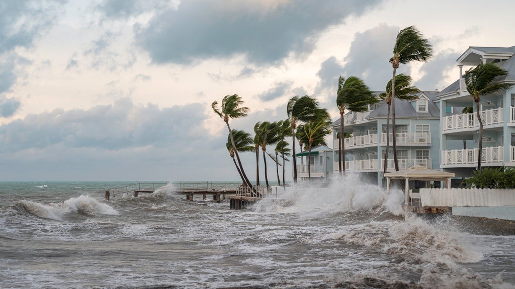
NOAA forecasts a shift from El Niño to La Niña for the 2024 hurricane season. This ENSO transition, paired with record-high sea surface temperatures, creates a volatile environment for Atlantic storms. Without the wind shear typically provided by El Niño, hurricanes can intensify rapidly. This shift underscores a critical need for resilience: property owners should review insurance coverage and implement safety precautions now to mitigate risks.

With the 2024 hurricane season just around the corner, the weather world is buzzing about a major shift. Conversations are centering on the transition from El Niño to the La Niña phase of the El Niño Southern Oscillation (ENSO).
A shift to La Niña in spring 2024 would mark the end of a short El Niño phase.
What is ENSO and why does it control the weather?
ENSO is a recurring climate pattern involving changes in water temperature and atmospheric pressure across the tropical Pacific Ocean. While the pattern starts in the Pacific, it dictates global weather—specifically within the Atlantic hurricane basin.
There are three distinct phases of ENSO:
• El Niño: The warm phase.
• La Niña: The cold phase.
• ENSO Neutral: A transitional period where ocean temperatures and winds are near their long-term averages.
While it’s not an officially timed cycle, we typically shift into different ENSO phases every two to seven years.
El Niño vs. La Niña: The Hurricane Connection
The primary difference between El Niño and La Niña phases is how they influence vertical wind shear, which is the change in wind speed or direction at different altitudes.
• During El Niño: Trade winds (those that move from east to west, flowing toward the Equator) weaken, allowing warm water to move east toward the Americas. In the Atlantic, this creates high vertical wind shear. These strong winds can rip developing hurricanes apart before they can grow.
• During La Niña: Trade winds strengthen, pushing warm water toward Asia. This causes wind shear over the Caribbean and Atlantic to decrease. Without those disruptive winds, it is much easier for tropical storms to form and intensify into major hurricanes.
What phase of the ENSO cycle will we be in for hurricane season 2024?
As of March 14, the National Oceanic and Atmospheric Administration (NOAA) forecasted a 62% chance of ENSO patterns drifting into a La Niña phase for summer 2024.
This announcement created some confusion because an El Niño advisory was still active. In early 2024, sea surface temperatures (SSTs) were still above average, but they were dropping quickly from the record highs recorded in 2023—the fifth-highest SSTs since 1950. Historically, there is a strong tendency for La Niña to follow powerful El Niño events, meaning spring 2024 likely marks the end of a short but intense El Niño cycle.
What will La Niña mean for Hurricane Season 2024?
The upcoming hurricane season has the makings to be an active one.
Between late 2020 and early 2023, the world was in a La Niña phase that fueled devastating storms like Hurricane Ian, Hurricane Nicole, and Hurricane Ida. This La Niña phase was a triple-dip event, meaning it persisted for three consecutive northern hemisphere winters.
Before La Niña officially arrives, NOAA expects a transition to ENSO-neutral conditions (an 83% likelihood as of April 11). However, sea surface temperatures in the North Atlantic are expected to remain near record highs throughout the year. When you combine exceptionally warm temperatures with the lack of wind shear caused by a developing La Niña, the result is a highly volatile environment for storm development.
Resilience through preparedness
While NOAA will release its formal seasonal forecast in late May, the current atmospheric signals point toward a volatile season.
Hurricanes are inevitable, but total devastation doesn't have to be. For those living in vulnerable areas of the U.S., this transition between ENSO phases should signal the need for immediate preparedness. This involves confirming insurance coverage, getting familiar with policy parameters, and planning for safety measures in the event of a storm.
Knowing your risk is the first step to ensuring a faster recovery.